
Grand Junction, CO – A powerful spring storm is bearing down on Colorado’s high country, bringing heavy snowfall and strong winds to several mountain regions.
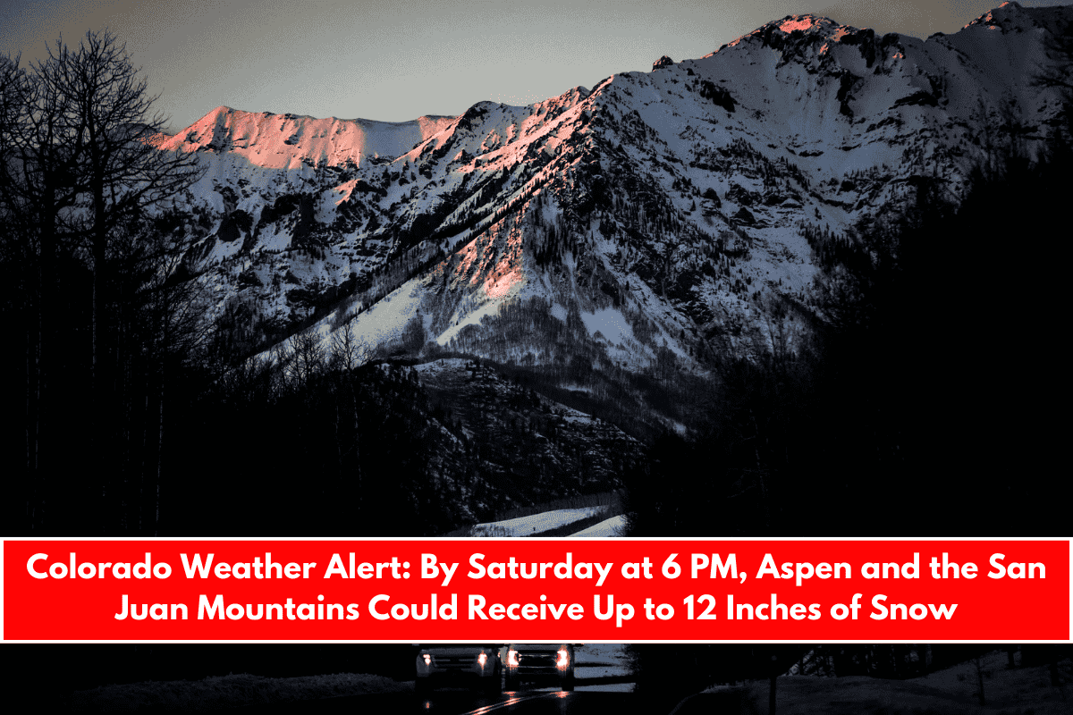
According to the National Weather Service in Grand Junction, a Winter Weather Advisory is in effect from midnight Thursday through 6 p.m. Saturday, with up to 12 inches of snow possible in higher elevations.
Even though it’s mid-April, winter isn’t done yet in Colorado’s mountains. Motorists and residents across affected areas should be ready for hazardous travel conditions, including reduced visibility and slick, snow-covered roads.
Which Areas Are Affected?
The advisory covers elevations above 8,000 feet, including well-known mountain towns and resorts such as:
- Aspen
- Telluride
- Silverton
- Vail
Also included are the San Juan Mountains, West Elk Mountains, Sawatch Range, and Central Mountain Valleys. These regions could see snow accumulations of 6 to 12 inches, with higher totals in some isolated areas.
Wind and Visibility Concerns
Along with heavy snowfall, winds may gust up to 45 mph, especially on ridgelines and passes. This will create blowing snow and whiteout conditions, making travel difficult or even impossible at times. There is also a chance of minor tree damage due to heavy, wet snow combined with gusty winds.
Road and Travel Impacts
Travel is expected to be dangerous throughout Friday and Saturday, particularly during morning and evening commutes. Mountain passes including:
- Monarch Pass
- Red Mountain Pass
- Vail Pass
may experience delays, closures, or traction law enforcement as snow piles up and visibility drops.
If you’re planning to travel in or around the high country:
- Delay non-essential travel if possible
- Check road conditions on COTrip.org or by calling CDOT’s 511 service
- Carry an emergency kit in your vehicle with blankets, food, water, and traction aids
- Drive slowly and increase following distance
Why This Storm Is Not Unusual for Colorado
Colorado’s high country is known for getting snow well into the spring season. While this system is strong, it’s not unusual for April, especially in regions above 8,000 feet. However, the combination of wind and snowfall totals means that people in these areas still need to take the storm seriously.
Even short trips can become dangerous if visibility drops or roads ice over. Being prepared and informed can help you avoid getting stuck or caught in an emergency.