
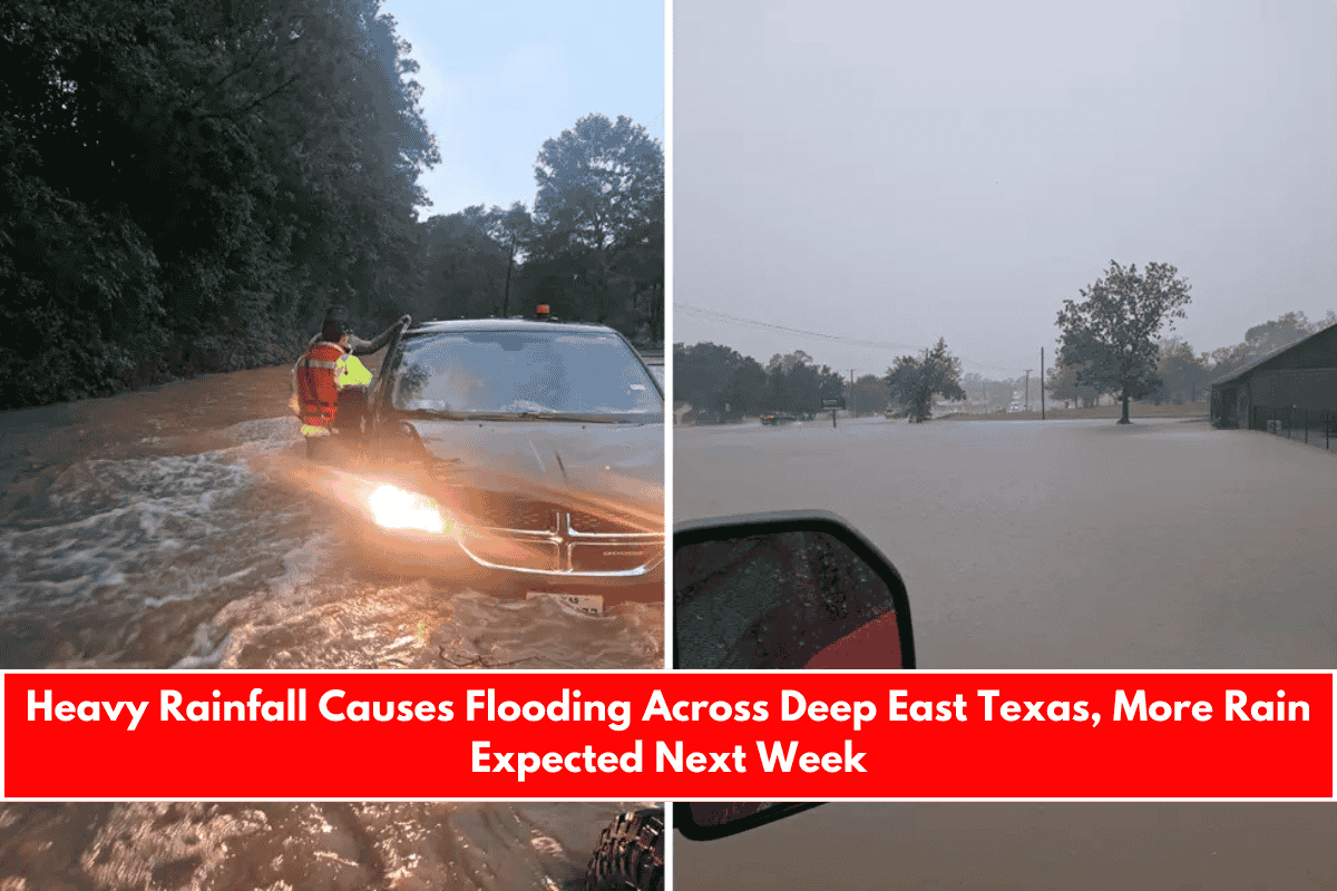
On Friday afternoon, heavy, long-lasting downpours brought significant rainfall to parts of Deep East Texas, leading to flooded roadways, underpasses, and parking lots. First responders and towing companies were kept busy with numerous calls throughout the day.
The Lufkin Police Department reported an overwhelming number of calls to dispatch, as areas like Highway 94 and surrounding business parking lots became inundated with water. The Hudson Volunteer Fire Department responded to many of these calls, focusing on flooded roadways and areas affected by the rainfall.
As the rain fell, Flash Flood Warnings were issued for several counties in the Pineywoods. While multiple areas saw heavy rainfall, the greatest amounts were concentrated in Lufkin and central Angelina County.
Rainfall Totals for East Texas Locations
Here’s a breakdown of rainfall totals for various East Texas locations, recorded by WunderMap:
- Penn Bonner Road (Hudson) – 6.00 inches
- Mountain View Road (Hudson) – 6.17 inches
- Zed Creek (Hudson) – 4.78 inches
- Old Bonner Road (Hudson) – 6.74 inches
- Highway 103 (Hudson/Central) – 5.94 inches
- Pollok – 2.62 inches
- Huntington – 4.28 inches
- Corrigan – 1.53 inches
- Lake Livingston (Pointblank) – 1.09 inches
- Livingston – 1.06 inches
- Diboll – 4.64 inches
- Crown Colony (Lufkin) – 5.09 inches
- Chestnut/Denman (Lufkin) – 5.78 inches
- Brookhollow (Lufkin) – 5.06 inches
- South 59 Construction Zone (Nacogdoches) – 2.48 inches
- Fredonia Hill (Nacogdoches) – 2.90 inches
- Nacogdoches High School – 2.15 inches
- Walmart (Nacogdoches) – 3.20 inches
- Central Heights – 2.28 inches
- Garrison – 2.24 inches
- Center – 1.51 inches
- Tenaha – 1.24 inches
- Allentown (Pollok) – 4.03 inches
- Cushing – 0.65 inches
- Broaddus – 1.17 inches
- 147 Bridge (Zavalla) – 0.52 inches
- Sam Rayburn Dam – 3.63 inches
- Jasper – 1.87 inches
- Woodville – 2.05 inches
- Westwood Shores (Trinity) – 2.21 inches
- Centerville (Trinity County) – 3.93 inches
- Lovelady – 2.31 inches
- Crockett – 0.87 inches
What’s Next? Another Round of Rain and Potential Flooding
The good news for the Pineywoods is that the forecast for the rest of the weekend looks promising. A late-season cold front is expected to bring sunshine by midday Saturday, with high temperatures in the 70s and some areas dipping into the upper 40s for overnight lows. However, this relief will be short-lived.
Rain chances will return starting Monday night and continue throughout the rest of the week. Weather models are predicting that 5 inches or more of rain could fall across the central sections of East Texas, bringing with it the risk of further flooding.
Tip for drivers: If heavy rain leads to more flooding next week, avoid driving near St. Luke’s Memorial Hospital, as Lake Frank Street is known to flood quickly in these conditions.
Stay tuned for updates and be prepared for more potential disruptions caused by rain and flooding in the coming days.