
On Tuesday, March 4, powerful storms swept through East Texas, bringing damaging winds up to 60 mph, widespread power outages, and confirmed tornado touchdowns in Harrison, Sabine, and Tyler Counties.
Now, forecasters are warning that another round of storms is on the way, impacting North-Central Texas to the Florida Panhandle. While the threat of extreme winds is lower, large hail and isolated tornadoes remain a concern.
Here’s what you need to know about the next storm system, including timing, risks, and weather outlook for the coming week.
Confirmed Tornadoes & Damage from March 4 Storms
The National Weather Service (NWS) confirmed that three tornadoes touched down in Harrison, Sabine, and Tyler Counties as part of Tuesday’s severe weather outbreak.
In addition to tornadoes, winds reaching 60 mph caused:
- Widespread power outages
- Downed trees and power lines
- Structural damage in multiple areas
Residents across the Pineywoods and Northeast Texas spent the following days cleaning up from the storm’s impact.
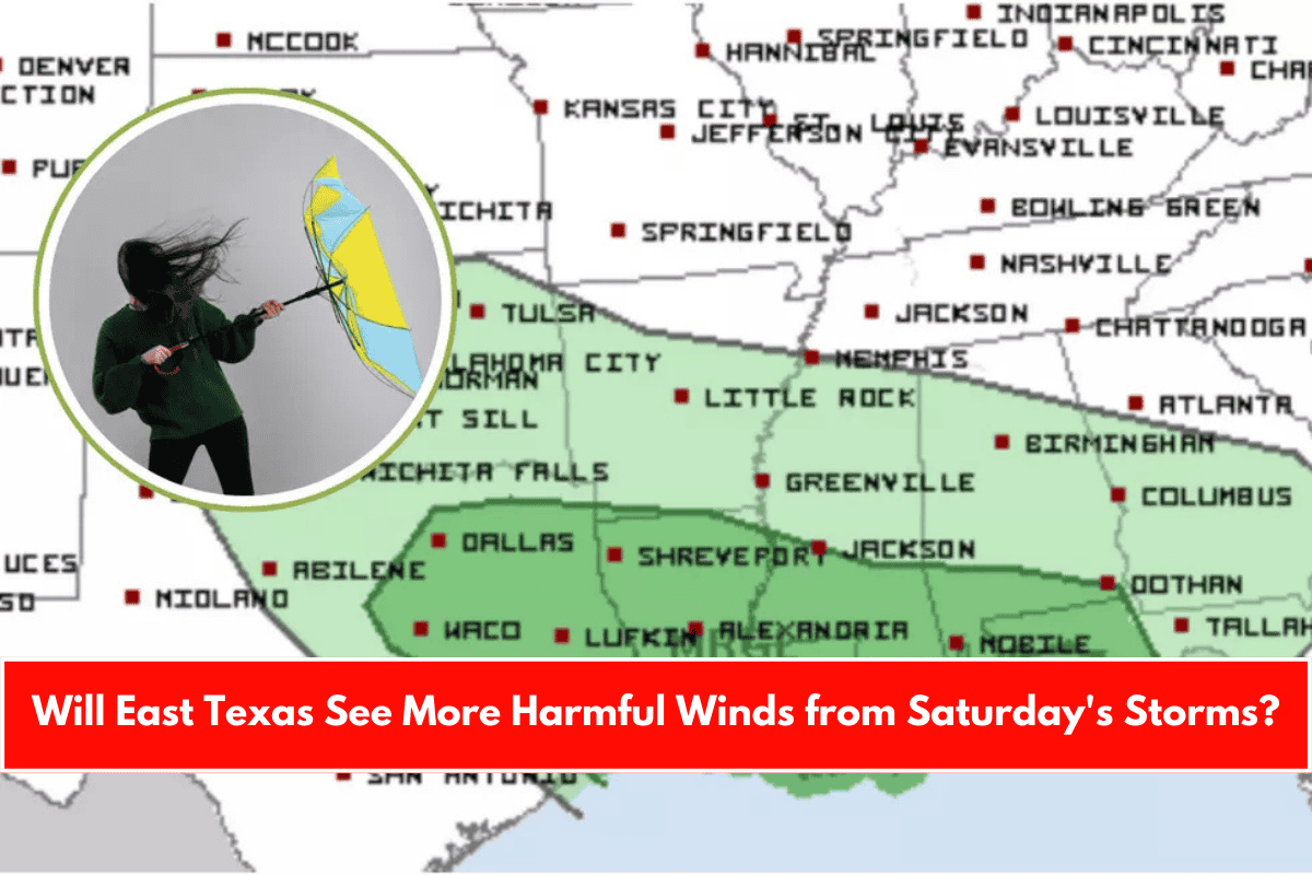
More Storms Expected This Weekend
The Storm Prediction Center (SPC) is closely monitoring another storm system set to arrive Saturday, March 9, into early Sunday morning.
Areas Affected
- Texas Cities at Risk: Dallas, Waco, Lufkin, Nacogdoches, Tyler, Longview, Beaumont
- Other Impacted States: Louisiana, Mississippi, Alabama, Florida Panhandle
The SPC has placed these areas under a “marginal threat” for severe weather, meaning storms could be scattered but still capable of producing damaging conditions.
What to Expect: Wind, Hail & Tornado Threats
Unlike Tuesday’s storm system, which had widespread damaging winds, this next round is expected to bring:
Isolated Tornadoes: A tornado or two is possible, but the conditions aren’t currently favorable for significant tornado activity.
Gusty Winds: Some strong winds are possible, but widespread damaging gusts are not expected.
Large Hail: The greatest threat with this system is the potential for hail-producing storms, particularly in stronger cells.
Forecasts Could Change: Weather conditions can shift quickly, so residents should stay weather-aware as Saturday approaches.
Timing of the Storms
- Saturday, March 9
- Expected time frame: 11 a.m. – 5 p.m.
- Impact Areas: Northeast and East Texas
After the storms pass, temperatures will drop into the 50s on Sunday before rebounding to the 70s on Monday. By the end of next week, highs could climb into the 80s.
Don’t Forget the Time Change!
- Daylight Saving Time begins this weekend!
- Set your clocks forward one hour on Saturday night/Sunday morning (March 10).